Find land for sale
Check property lines and public ownership
Look up soil maps, elevation, and more
Analyze Land in Minutes
Unlock rural land insights, ownership info, and sales data so you can move fast on new opportunities and value land with confidence.
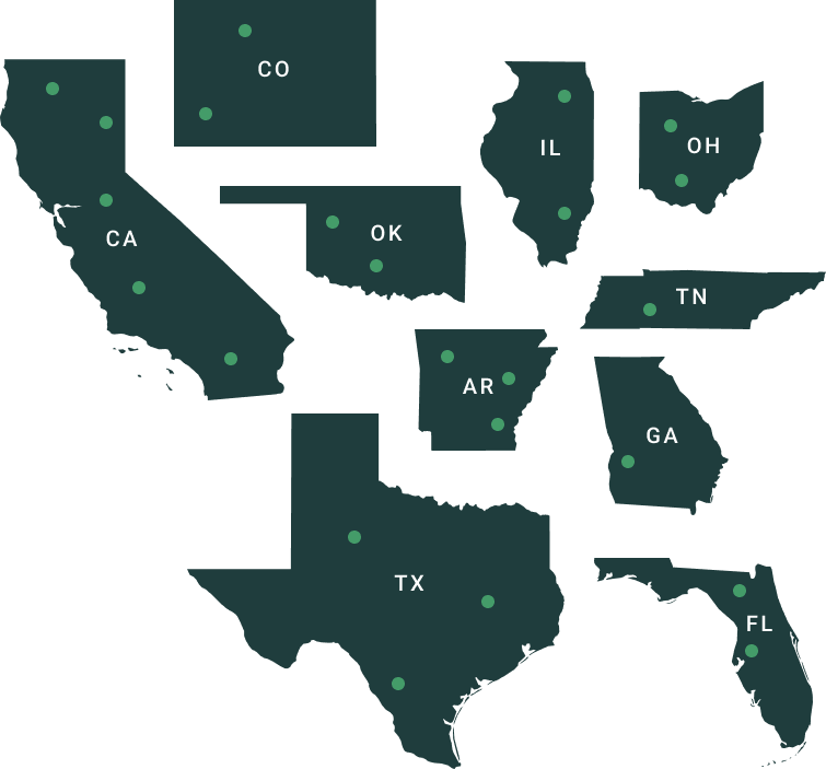
TRUSTED BY LAND PROFESSIONALS
.png)


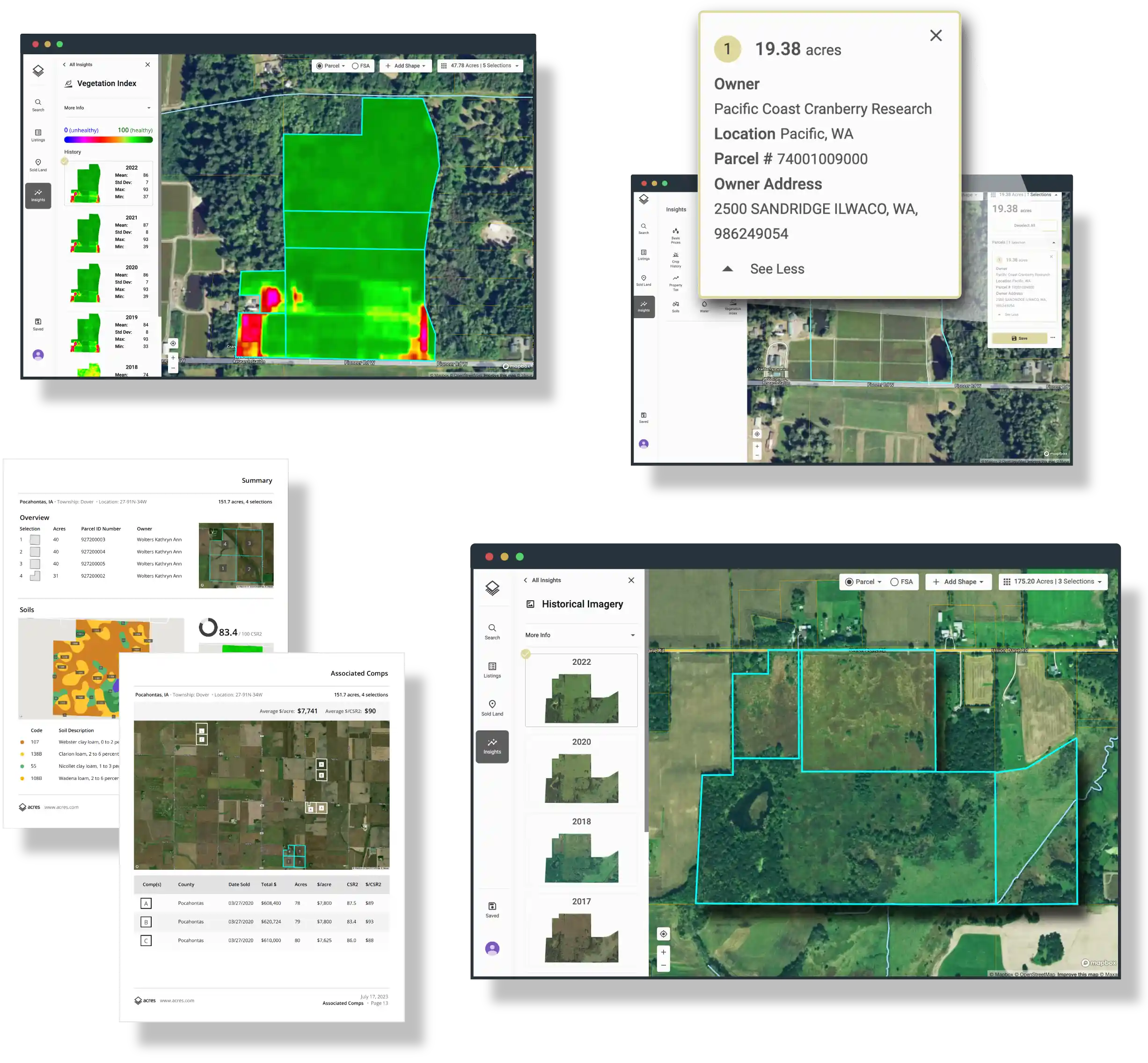
Reveal What You Can’t See on the Ground
Value land, identify potential risks, and ask questions about historic land use with key insight layers.
Compare Plans
Interactive GIS Layers

Historic Imagery

Crop History

Property Tax

Vegetation Index

Timber Site Index

Power Grid

Elevation and Topography

Flood

Soil Maps

County Rent

County Yield

Water (CA, NE)
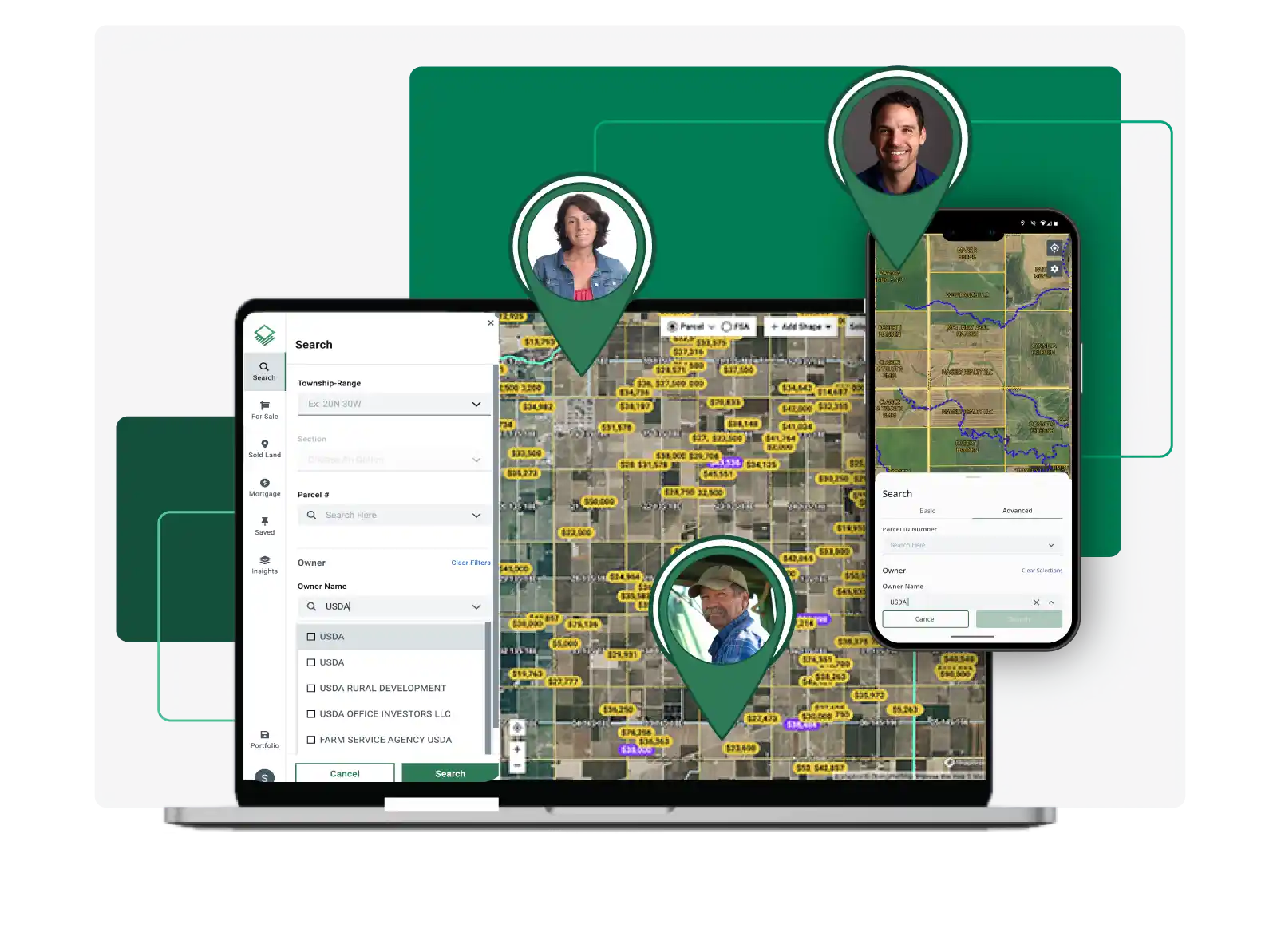
Easy Property Lookup
Quickly search millions of U.S. properties by parcel number, owner name, and more.
Compare plans
Explore Land for Sale
Dreaming of owning land? Search listings based on your criteria to find a property that fits your needs.
Search Listings
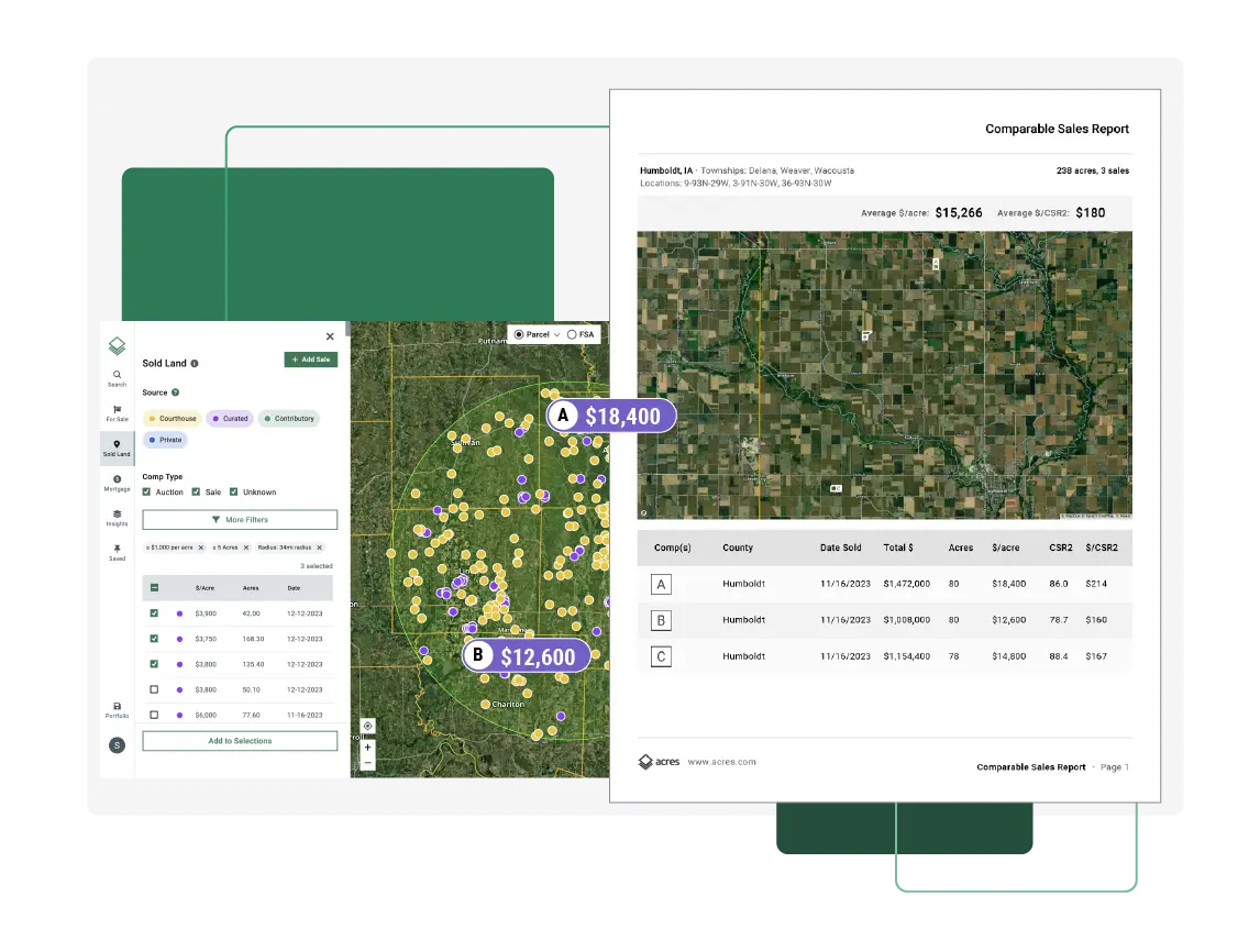
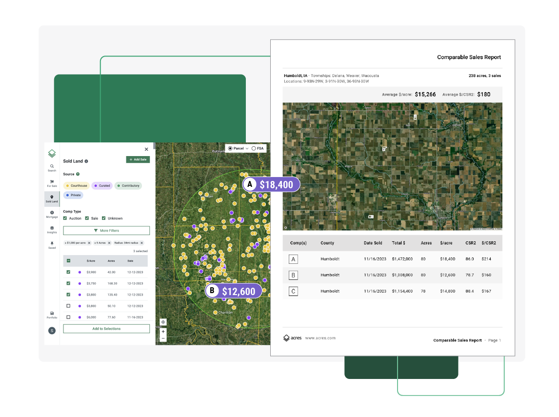
Quick Market Analysis Reports
Export shareable market area reports with the latest rural property sales data available.
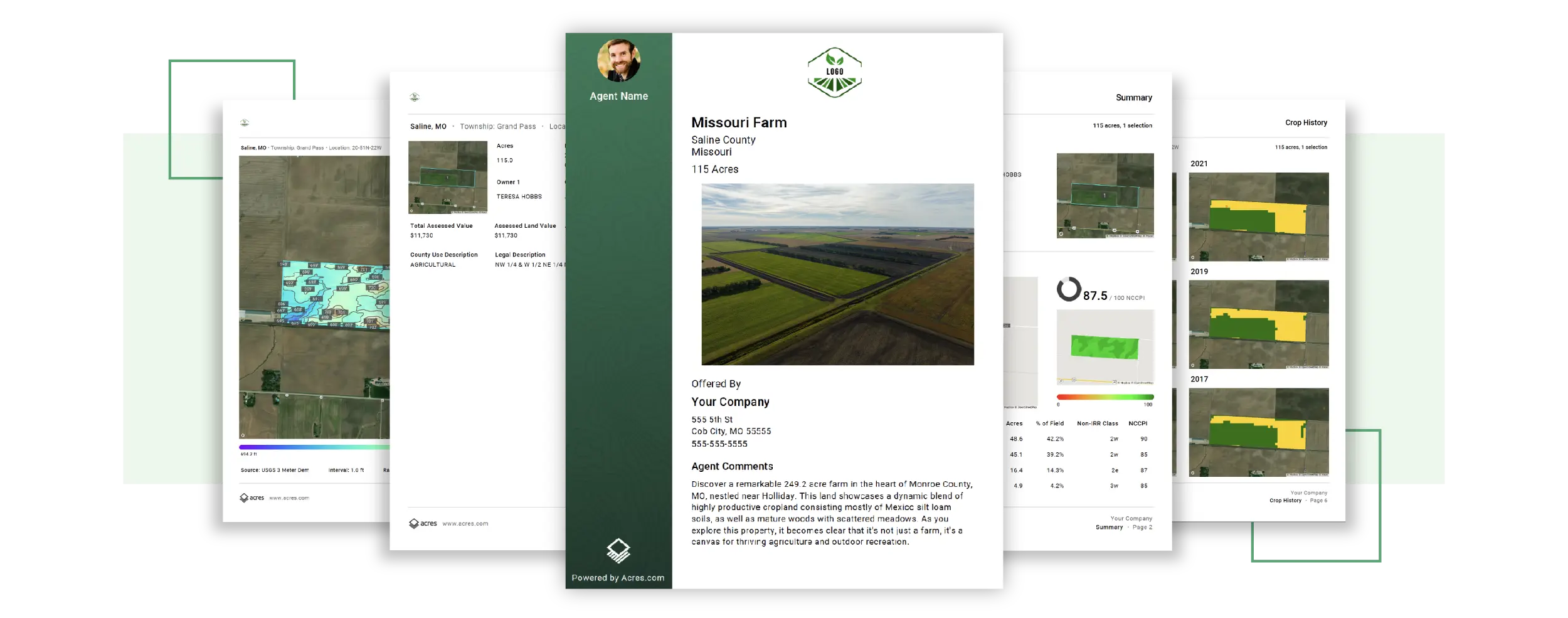
Share Sleek Property Reports
Showcase properties and share key insights with customizable PDF reports featuring your brand.
What People Are Saying
"Acres has saved me a lot of time and effort, as I no longer need to juggle between multiple mapping platforms. I highly recommend Acres to anyone in the real estate industry."
- Jake H., Land Broker

Alex C.
"They’ve got a wealth of information, including parcel boundaries, owner names, great imagery, soil scores, topo map. I like that I can easily find a property and share it or save it for later."
Nathan A.
"Acres is a great tool that I utilize constantly. It provides easy access to data that I normally can't easily find. I use Acres to quickly access property features like flood zones and the topography."
Tarra W.
"What an amazing app. It's absolutely full of information for your investment business or personal interest. An app that's resourceful for several reasons, but I'd rate it 10 stars if I could."
Debbe G.
"I always looked each parcel up individually online. Very time consuming! Thank you for a great app that have me back hours of my time!"
Christopher C.
"This app is a groundbreaker that's been needed for a long time, just a colossal data-gathering undertaking. Nice work."
Why Acres
Whether it’s an investment, a business opportunity, or a personal legacy, buying land is a monumental decision. However, finding high quality land data that's easy to understand is a challenge.
That’s where Acres comes in. Created to help individuals make confident decisions about buying, selling, or investing in land, Acres makes land research easier than ever. When you join Acres, you'll be a part of a growing platform built to support a more transparent and efficient land marketplace for everyone.
That’s where Acres comes in. Created to help individuals make confident decisions about buying, selling, or investing in land, Acres makes land research easier than ever. When you join Acres, you'll be a part of a growing platform built to support a more transparent and efficient land marketplace for everyone.